


Flood warnings and flood alerts are active for areas of Cumbria.
As rain continues to batter the county, the Government has said there is a risk of flooding in areas of Cumbria and people should be prepared.
We will be updating the list as the day continues – please let us know what it is like in your neighbourhood – email [email protected]
Cumbria’s agencies have also set up a task force after the county continues to be battered by rain.
The multi-agency co-ordination group was set up overnight as partner agencies deal with localised flooding in Cumbria following persistent rainfall.
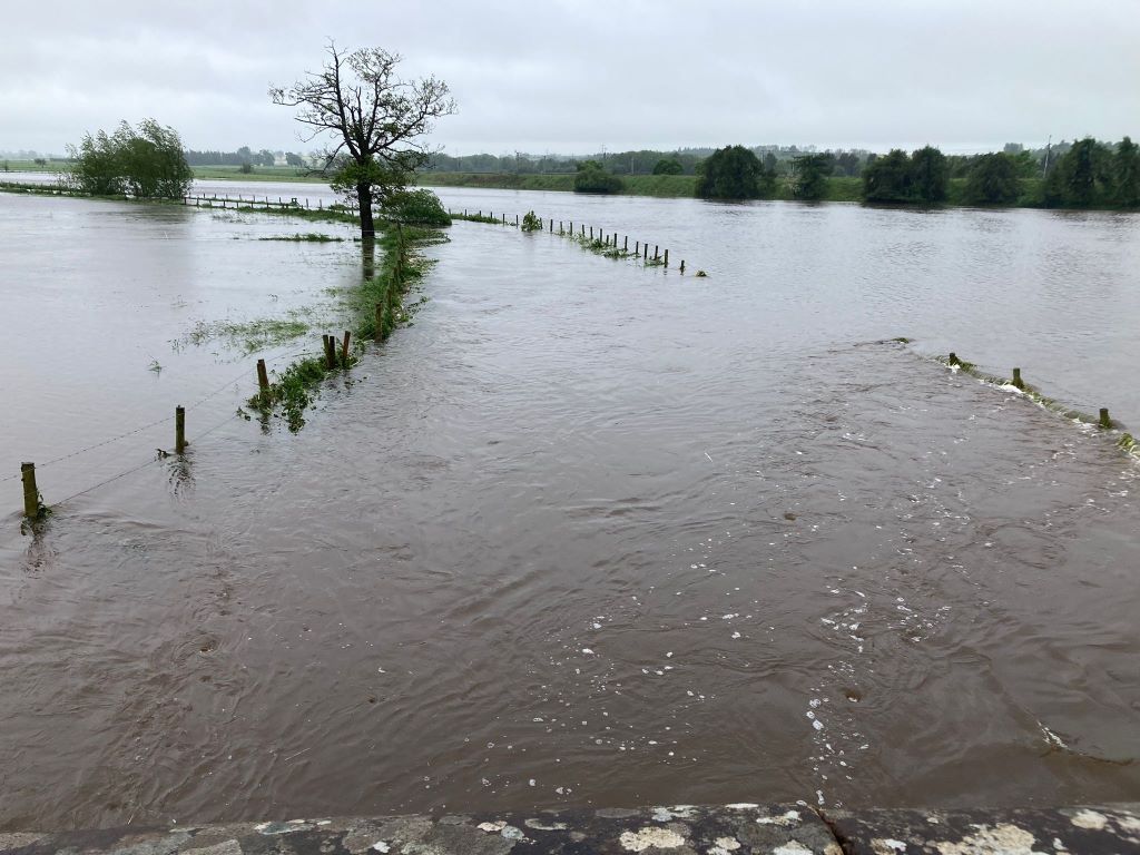
A number of properties have been affected in the Stockdalewath area, near Carlisle, with one property evacuated.

Chief Superintendent Mick Bird, of Cumbria police, said: “Emergency services have been responding throughout the night to calls for service following persistent rainfall, which has resulted in flooding in some parts of the county.
“The flooding is on a small scale and the public can be reassured that the weather forecast is expected to be much more favourable throughout today.
“We do expect some impact to travel within Cumbria with some flood water in parts of the county.
“If you are travelling this morning, please take care. If you do come across a flooded road, please do not attempt to travel through as you cannot be sure of the water’s depth.”
Houses in Lazonby were flooded overnight, with the fire service called at around 4.30am today.
Bitts Park play area in Carlisle has been closed due to flooding.
Cumberland Council said it expected it to be closed until next week while an assessment and clean-up of the site took place once the water receded.

Traffic

Long tailbacks are being reported between Southwaite Services and Junction 42 on the M6 and it appears the road has been closed from Junction 42 to Durdar, although that has not been confirmed officially.
Roads closed at 4pm:
- Bitts Park, Carlisle
- Moorhouse to Thornby Road at Moorhouse Mill
- Monkill to Burgh
- St Ninians Bridge, Carlisle
- B5301 Arkleby Bridge
- Etterby Rail bridge, Carlisle
Roads passable with care at 2pm:
- High Burthwaite, Durdar
- Baldwinholme
- Orton Cross roads
- Cumwhinton Village
- Cumwhinton Rd, Carlisle
- Wreay
- A591 Bassenthwaite (landslip)
- Scotby to Cumwhinton
Dalston Road in Carlisle, near Pirelli, has been cleared following earlier flooding.
Car parks
In Carlisle, Swifts Bank car park has been closed by the Environment Agency as a precaution and Castle car park has been closed due to flooding.
People are asked to use Caldew Riverside, Viaduct or West Walls car parks if possible.

Public transport

Due to the weather causing significant disruption on the West Coast Main Line with flooding on the route north of Carlisle, TransPennine Express is strongly advising customers to not travel on the following routes today, Thursday May 23:
- Services between Manchester, Liverpool, Preston to Carlisle, Glasgow and Edinburgh
Darren Higgins, commercial director at TransPennine Express, said: “Due to flooding on the railway line north of Carlisle, train services are significantly disrupted.
“The safety of our customers and colleagues is our priority and we are urging customers not to travel between Manchester, Liverpool, Preston to Carlisle, Glasgow and Edinburgh.
“Anyone planning on travelling by train today can choose to defer their travel or claim a refund.”
There is severe disruption on the Cumbria Coastal Line from Barrow to Carlisle due to flooding.
Avanti West Coast said its services between Preston and Glasgow/Edinburgh have been cancelled due to heavy flooding on the railway between Carlisle and Lockerbie blocking the line in both directions. It is advising passengers not to travel.
Trains between Carlisle and Leeds are returning to normal, but National Rail has warned travellers that services may still be cancelled or delayed.

Flood warnings
Flooding is expected
River Eden and Caldew at Carlisle, Devonshire Walk, West Coast Mainline, Bitts Park, Cricket Club
River levels are high and forecast to rise further on the Rivers Eden and Caldew due to exceptionally heavy rainfall. Areas at risk are Devonshire Walk, West Coast Mainline, Bitts Park, Cricket Club and The Sheepmount.
River levels are expected to remain high. Incident response staff have closed flood defences. Avoid using low lying footpaths near local watercourses. You should avoid walking, cycling or driving through flood water.
Flood warning area: River Eden and Caldew at Carlisle, Devonshire Walk and West Coast Mainline, Bitts Park, Cricket Club, Sheepmount.
River Eden at Carlisle, Rickerby Park, Swifts and Stoneyholme Golf Courses
River levels have risen on the lower River Eden due to heavy rainfall.
Areas most at risk include low lying roads, car parks, public spaces and recreational facilities at Rickerby Park, Swifts and Stoneyholme Golf Courses. Flooding is expected at low lying roads, car parks, public spaces and recreational facilities at Rickerby Park, Swifts and Stoneyholme Golf Courses.
River levels are expected to remain high throughout the morning.
Incident response staff are closing flood gates and checking defences. Avoid using low lying footpaths and any bridges near local watercourses and do not attempt to walk or drive through flood water.
Flood warning area: Low lying roads, car parks, public spaces and recreational facilities at Rickerby Park, Swifts and Stoneyholme Golf Courses.
River Eden at Low Crosby, Warwick Holmes
River levels are high on the River Eden. Flooding is forecast to affect locations near the River Eden, with low lying land expected to be most affected, particularly around farms and residential properties in the Warwick Holmes area.
River levels are expected to remain high. Avoid using low lying footpaths near local watercourses. You should avoid walking, cycling or driving through flood water.
Flood warning area: Low lying roads, agricultural land and isolated properties adjacent to the River Eden in the Warwick Holmes area.


Flood alerts
Flooding is possible
Lower River Lune and Conder
Flooding is possible around the River Lune, Conder and Keer and other watercourses from Kirkby Lonsdale to Galgate including Gressingham, Carnforth, Hornby, Wray, Bentham and Lancaster.
Flood alert area: River Lune, Conder and Keer and other watercourses from Kirkby Lonsdale to Galgate including Gressingham, Carnforth, Hornby, Wray, Bentham and Lancaster.
Rivers Caldew and Petteril
Areas most at risk include Rivers Caldew and Petteril from the Lakeland Fells to Carlisle including Greystoke, Newton Reigny, Plumpton, Stockdalewath, Sebergham and Denton Holme in Carlisle.
No property flooding is expected
Flood alert area: Rivers Caldew and Petteril from the Lakeland Fells to Carlisle including Greystoke, Newton Reigny, Plumpton, Stockdalewath, Sebergham and Denton Holme in Carlisle.
Rivers Cocker, Marron and Derwent
Areas most at risk include Lower Derwent from Bassenthwaite Lake to the coast at Workington. The Cocker from Crummock Water to Cockermouth. The River Marron from Ullock to its confluence with the Derwent near Bridgefoot.
No property flooding is expected but continued heavy rainfall is forecast.
Rainfall and river levels are being monitored and are checking rivers for blockages in the area.
Avoid using low lying footpaths and any bridges near local watercourses and do not attempt to walk or drive through flood water.
Flood alert area: Lower Derwent from Bassenthwaite Lake to the coast at Workington. The Cocker from Crummock Water to Cockermouth. The River Marron from Ullock to its confluence with the Derwent near Bridgefoot.
Rivers Ehen, Calder, Irt and Esk
Areas most at risk include Rivers Ehen, Calder, Irt and Esk and other watercourses, from Harrington to Annaside including low lying areas around Whitehaven, Cleator Moor, Egremont, Gosforth, Eskdale and Bootle.
Flood alert area: Rivers Ehen, Calder, Irt and Esk and other watercourses, from Harrington to Annaside including low lying areas around Whitehaven, Cleator Moor, Egremont, Gosforth, Eskdale and Bootle.
Upper River Eden
River levels are rising on the Upper River Eden due to heavy rainfall.
Areas most at risk include River Eden and other watercourses, from Kirkby Stephen to Temple Sowerby including low lying areas around Brough, Warcop, Great Ormside and Appleby.
Flood alert area: River Eden and other watercourses, from Kirkby Stephen to Temple Sowerby including low lying areas around Brough, Warcop, Great Ormside and Appleby.
Flood warnings and alerts removed
- Cairn Beck and Trout Beck at Warwick Bridge
- Coledale Beck at Braithwaite
- Whelpo Beck, Gill Beck and Cald Beck at Caldbeck
- Rivers Duddon, Crake and Mill Beck
- River Caldew at Carlisle, Viaduct Estate Road area
- River Caldew at Cummersdale
- River Eden and Caldew at Carlisle, Devonshire Walk, West Coast Mainline, Bitts Park, Cricket Club
- River Petteril at Harraby Green
- Speet Gill at Wigton, Burnfoot
- Wiza Beck and Black Beck at Wigton, Station Road
- Wiza Beck, Flosh Beck, Speet Gill and Black Beck at Wigton
Today’s weather
Here’s what today is looking like, according to the Met Office:
Travel disruption and flooding is possible in places on Thursday morning, especially across north Wales and northwest England ⚠️
— Met Office (@metoffice) May 22, 2024
Rain also across Scotland and Northern Ireland but less heavy than on Wednesday
Drier in southern Britain with sunny spells developing in places🌤️ pic.twitter.com/NUlAqWlLXP
Carlisle was the wettest place in the UK yesterday, with 65.6mm of rainfall:
A very wet day across most of the UK today but where saw the highest rainfall totals?
— Met Office (@metoffice) May 22, 2024
See our extremes below 👇 pic.twitter.com/ZfUXs5sNib


