


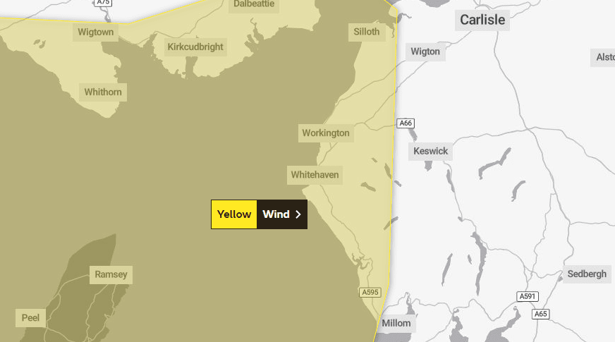
The Met Office has issued a warning for winds of up to 70mph in Cumbria.
It said the strong winds are part of Storm Betty and they are expected to from 6pm today, Friday August 18, until noon tomorrow, Saturday August 19, bringing the risk of disruption to transport, travel and temporary infrastructure.
The storm is expected to bring its strongest winds along the coast where gusts of 60mph to 70mph are possible, while winds of 45 to 55mph are expected elsewhere in the county.
The weather service added that given the time of year with trees in full leaf and temporary structures such as tents and marquees in place for festivals and events that disruption is likely.
High-sided vehicles and caravans are also likely to be impacted.
The storm has been named today by the Irish Met Office, Met Éireann, and is expected to impact western areas of the UK in particular.
Met Office chief meteorologist Jason Kelly said: “Friday and Saturday will see unseasonably wet and windy conditions for much of the UK.
“While Storm Betty will have higher impacts in Ireland, exposed Irish Sea coasts of the UK (including Cumbria) could see gusts in excess of 70mph, with around 50mph more widely.”
What to expect
- Some damage to buildings, such as tiles blown from roofs, could happen
- Road, rail, air and ferry services may be affected, with longer journey times and cancellations possible
- Some roads and bridges may close
- Power cuts may occur, with the potential to affect other services, such as mobile phone coverage
- Injuries and danger to life could occur from large waves and beach material being thrown onto sea fronts, coastal roads and properties


