

When wintry weather hits Cumbria and brings icy conditions, our inbox is deluged with people across the county asking the same question – why aren’t my roads being gritted?
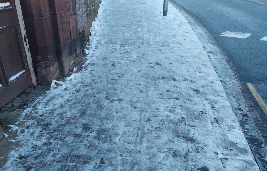
From pavements to town centres and roads in estates – there’s no shortage of frustrated people dealing with ice on the roads, preventing them from getting to the places they need to go.
Here at Cumbria Crack, we decided to go on a deep dive into the world of salt, grit and ice to find out the answers behind why some roads are gritted and why some roads aren’t.
The roads are the responsibility of the county’s two unitary authorities – Westmorland and Furness Council and Cumberland Council.
The authorities were created on April 1 – previously, roads were the responsibility of Cumbria County Council.
The hierarchy of Cumbrian roads
Cumberland Council
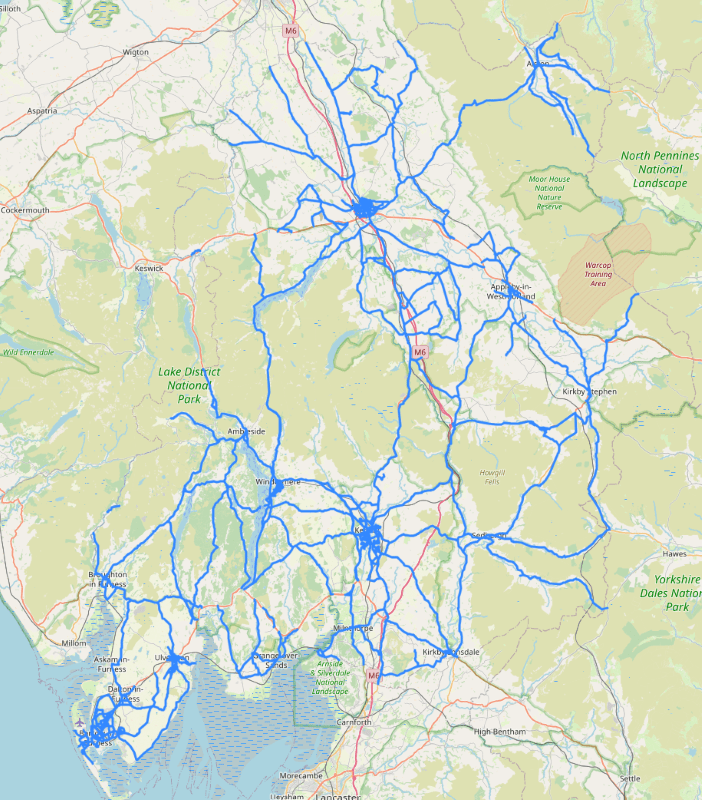
Cumberland Council’s highway network has over 3,600km of carriageway. Cumbria has a huge network of roads and in order to tackle them with grit, a hierarchy has been created.
The policy works preventatively by pre-salting the county’s most essential roads before bad weather.
But to define what makes a road essential, the council have split them into levels of priority – primary, secondary, category 3, urban footways.
Primary roads are gritted within two-and-a-half hours of a decision to salt the roads. Primary roads are those which carry a large volume of traffic and link the major economic centres in the county and the region.
Secondary roads are also gritted within two-and-a-half hours. Secondary roads serve more local needs, but still carry significant volumes of traffic.
Wherever possible the primary and secondary roads will be pre-treated before 8am.
Combined, primary and secondary roads account for approximately one third of the road network in Cumberland.
Primary routes
These are the primary routes and reflect the Resilient Road Network and includes non-trunk motorways and principal roads. These routes are treated based on forecasted events such as ice, snow or frost.
Generally, the intention is to pre-treat the network before the forecasted weather event actually takes place.
In normal circumstances this pre-treatment activity should be completed before the morning rush commences.
Secondary routes
Secondary routes are routes which have some strategic importance but not enough to include them in the primary network and in many cases, they are also local known problem areas.
Like primary routes, these are treated in the same way but only after the primary routes have been completed. If the forecast is significant these may be completed at the same time as primary routes in some areas.
Category 3
Category 3 and unclassified roads in rural and town centre locations. These routes are treated following a longer term forecast where the forecast suggests a period of prolonged bad weather.
Teams will be deployed prior to the forecasted bad weather to treat the remaining routes during day light hours only, dropping back on the primary and secondary routes when required.
Category 3 roads include those that:
- Serve hospitals with A&E and the key facilities of critical infrastructure providers, including access routes to all schools.
- Lead to strategic and key employment centres, major distribution depots and transport interchanges and important commuter routes
- Serve bus stations and important public transport routes with a service frequency of at least one bus per 10 minutes.
- Serve industrial sites listed under the Control of Major Accident Hazards Regulations and the Radiation (Emergency Preparedness and Public Information) Regulations 2001.
- Serve military establishments.
- Serve single access to villages.
- Link to the strategic road network.
- Lead to crematoriums.
Urban footways
Treatment of footways in urban areas (main shopping areas and busy urban areas) will be treated in line with the Category 3 network and treated following a longer term forecast where the forecast suggests a period of prolonged bad weather.
Priority one and two roads combined account for around a quarter of the road network in Westmorland and Furness and a third of the roads in Cumberland area.
Prior to the unitary authorities being created, a spokesman for the county council told us: “We treat what we’d call third priority routes, which includes footways in town centres when we have three or more days of consistently cold weather. In some areas, district councils treat a small number of footways.”
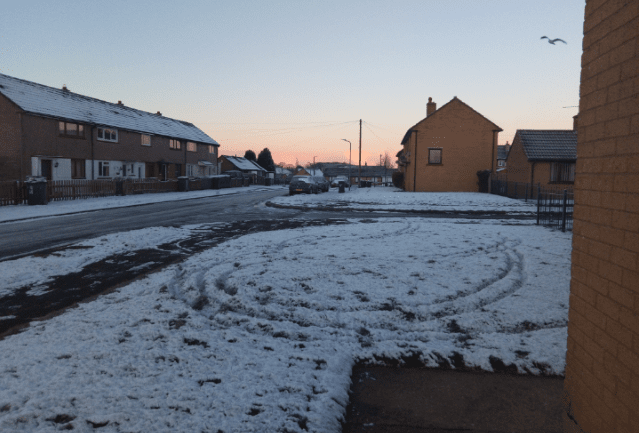
Residential roads, minor roads or housing estates actually fall outside the priorities, and are considered as ‘other’ roads.
The county council said that these areas were typically not gritted as they do not carry high enough volumes of traffic to activate salt and can be difficult to access with gritters due to parked cars.
Westmorland & Furness Council
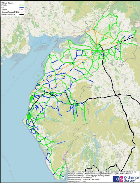
The authority has a fleet of 20 gritters and for 2024/2025, there is a stockpile of 12,000 tonnes of salt at its depots in Alston, Barrow, Millness, Kirkby Stephen and Penrith.
The council’s road network is split into 20 priority one and priority two gritting routes.
Priority one and two roads combined account for around 840 miles, which equates to a quarter of the road network in Westmorland and Furness – the same distance as driving from Kendal to Zurich in Switzerland.
It can take gritters up to five hours to grit one road.
There are around 3,000 grit bins and salt heaps across the Westmorland & Furness area. People are asked to use salt sparingly – as a rough guide, a tablespoon of salt should cover a square mile.
Priority one roads
Priority one roads are gritted approximately within two-and-a-half hours of a decision to grit the roads. They carry a large volume of traffic and link the major economic centres in the county and the region.
Priority two roads
Priority two roads are gritted within five hours. Wherever possible, these roads will be pre-treated before 8am.
Priority two roads serve more local needs, but still carry significant volumes of traffic.
Are the councils responsible for all roads in Cumbria?
National Highways manage and maintains some routes within Cumbria, on behalf of the Secretary of State.
These are:
- M6
- A66
- A595 – from the A66 to Calder Bridge
- A69 – from Carlisle M6, Junction 43, heading east
Carlisle Northern Development Route (CNDR) manage and maintain some routes within Cumberland, on behalf of Cumberland Council.
Continual liaison will take place between the highways authority (Cumberland Council), National Highways and CNDR and its managing agents over action taken during the winter, it said.
Generally, in the areas the councils do not routinely treat, yellow grit bins are provided for safety in areas such as where roads have bends, steep gradients or near rural schools.


