


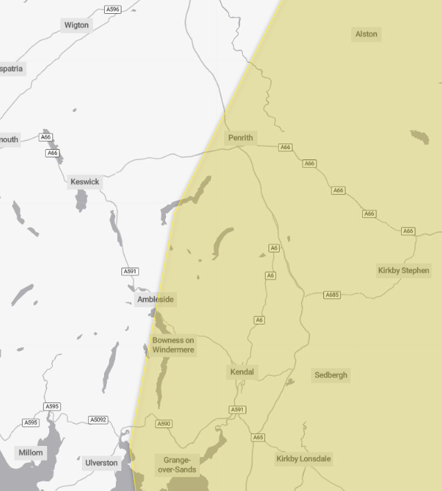
A thunderstorm warning has been issued for part of Cumbria.
The Met Office has issued a yellow warning for heavy, thundery weather from Friday at 9pm until Saturday at 6pm.
It said thundery rain will reach the south of the warning area later Friday before spreading north to affect much of England through Saturday.
Rain will likely be locally torrential, bringing 20 to 30mm in less than an hour in many places, with 60 to 90mm in less than three hours possible in a few places.
Whilst rain will clear from the south of the area by early Saturday afternoon, further thunderstorms are likely to develop.
As well as heavy rain, impacts from frequent lightning, gusty winds and large hail are also likely.
What should I expect?
- Spray and sudden flooding could lead to difficult driving conditions and some road closures
- Where flooding or lightning strikes occur, there is a chance of delays and some cancellations to train and bus services
- Power cuts might occur and other services to some homes and businesses could be lost
- Flooding of homes and businesses could happen quickly, with damage to some buildings from floodwater, lightning strikes, hail or strong winds
- Fast flowing or deep floodwater is possible, causing a danger to life
- Some communities might become cut off if roads flood
Why do you bother sharing weather warnings?
Weather warnings are issued to let people know what weather is in store for their area and what its impact could be.
The Met Office is the UK’s official weather service and it is responsible for issuing weather warnings to the public.
There are three main levels of weather warning:
- Yellow – which asks people to be prepared for disruption
- Amber – which asks people to change plans that could be impacted by the weather and take action to protect themselves and their property
- Red – which is issued for weather that poses a danger to life and asks people to immediately take direct action to keep themselves and others safe from impacts of the weather
Yellow and amber warnings represent a range of impact levels and likelihoods. This means it is important for people to read each warning to know what level of impact to expect in their local area – and how likely those impacts are to occur.
The Met Office began issuing ‘impact-based’ warnings in 2011 – which means that warnings are issued when the weather may have an impact on people’s day to day lives.
Previous to this, warnings were issued to the public when certain weather thresholds or levels were reached.
Impact-based warnings take multiple factors into account – these include time of day, if it may impact traffic, time of year, if the weather is unusual, if there are any seasonal events taking place and if the area is well equipped to deal with the weather.
Each warning level is designed to help people take steps to minimise the chances of disruption in their lives.


