

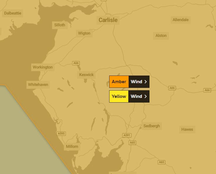
The Met Office has issued a severe weather warning for wind in Cumbria.
Storm Dudley is expected to affect the UK on Wednesday night and Thursday, bringing a period of very strong and disruptive winds.
An amber warning – which means there will be an increased likelihood of impacts from severe weather and possible “danger to life” – will come into force at 6pm on Wednesday and is due to run until 9am the following morning.
What to expect
- Road, rail, air and ferry services may be affected, and some roads and bridges are likely to close, leading to longer journey times and cancellations.
- Probably some fallen trees and damage to buildings, such as tiles blown from roofs
- There is a good chance that power cuts may occur, with the potential to affect other services, such as mobile phone coverage
- Injuries and danger to life is likely from large waves and beach material being thrown onto coastal roads, sea fronts and properties
What does the Met Office say?
“Very strong westerly winds are expected to develop across western Scotland and northern Northern Ireland late Wednesday and extend eastward across southern Scotland and northern England during the evening.
“There is still some uncertainty in the timing and location of the strongest winds but there is the potential for inland wind gusts of 70-80 mph in places. Gusts of 80-90 mph are possible around exposed coasts and hills.”
A third weather warning – yellow in severity – has been issued for winds on Friday.
Storm Eunice is likely to affect the UK on Friday bringing a period of very strong winds that could cause significant disruption.
What to expect
- There is a small chance that flying debris will result in a danger to life, with fallen trees, damage to buildings and homes, roofs blown off and power lines brought down
- There is a small chance that injuries and danger to life could occur from large waves and beach material being thrown onto sea fronts, coastal roads and properties
- Where damaging winds occur, there is a chance that long interruptions to power supplies and other services may occur
- There is a small chance that roads, bridges and railway lines could close, with long delays and cancellations to bus, train, ferry services and flights
What does the Met Office say?
“Extremely strong winds may develop over southwest England early on Friday, before spreading north and east during the morning. It is not yet clear where within the warning area the strongest winds will be but gusts of 60-70mph are possible over a reasonably large area with a small chance of a brief period of gusts reaching 80mph even inland.
“Coastal winds are likely to be the strongest. In addition to the wind, there is the potential for a period of snow and perhaps blizzard conditions, most likely over northern England, parts of Scotland, Northern Ireland and north Wales. However, this is very dependent on the track of the weather system and most places will see heavy rain instead.”
Have you read?
Electricity engineers on standby for storms Dudley and Eunice


