

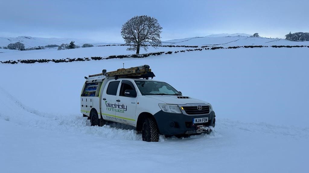
Electricity North West engineers are on standby as Storm Bert is set to hit the region this weekend.
The network operator has plans in place to monitor and respond to any network damage caused by the storm.
Alan Astall, head of network control for Electricity North West, said: “We have well-rehearsed plans in place to minimise any impacts for residents and businesses. Strong winds can blow debris into overhead lines causing power cuts, while snow and heavy rain can cause access issues for our teams.
“Our main priority is safety so if you do notice any damage to the network, for example damaged overhead lines or electricity poles, contact us immediately by calling 105.
“And if you or someone you know would be adversely affected by a power cut, you can join our free Extra Care Register for a bit of additional help and support.”
Storm Bert is the second named storm of winter after Storm Ashley caused multiple power cuts in October where engineers responded quickly to restore power to more than 20,000 properties.
Alan added: “We actively manage the power network 24/7, 365 days a year but when bad weather is forecast we step up the number of teams we have on standby so we can respond quickly.
“We prepare throughout the year with our teams of tree cutters cutting back trees from overhead lines, and our engineering teams installing new equipment to identify network issues and restore power faster to reduce the impact on customers.”
Cumbria is set to be hit by heavy snow, ice and rain over the next few days.
The Met Office has issued four days of yellow weather warnings for all of Cumbria as Storm Bert hits the country.
Heavy snow and rain are due from 4am on Saturday, November 23, until 9am on Sunday November 24.
Warnings for wintery showers and patches of ice have also been issued for this evening, overnight and tomorrow, Friday November 22.
The weather forecaster said icy stretches are expected on untreated surfaces and some travel disruption may occur.
Heavy snow is expected on the Saturday followed by a rapid thaw and rain on Saturday night, which the weather forecaster has said may cause some disruption.
It added: “Outbreaks of rain will spread northeastwards on Saturday, preceded by a spell of snow across parts of northern England and Scotland.
“Whilst snow will become increasingly confined to higher elevations with time, there is the chance of a transient period of snow to low levels in some areas, with perhaps as much as five to 10 cm accumulating in places, especially the Vale of York, before turning back to rain.
“Temporary snow accumulations of 10 to 20 cm are possible on ground above 150m, with perhaps as much as 20 to 40cm above 300m.
“In addition, the rapid thaw of lying snow as milder air arrives, with perhaps an additional 20-40 mm of rain in some upland areas during Saturday night, will lead to a greater likelihood of rainfall impacts later in the period.”
Strong winds are also expected and difficult driving conditions are expected, particularly over higher level routes. Power cuts and interruptions are also likely.
What should I expect?
- There is a small chance that power cuts will occur and other services, such as mobile phone coverage, may be affected
- There is a slight chance that some rural communities could become cut off
- There is a small chance that homes and businesses could be flooded, causing damage to some buildings
- Where flooding occurs, there is a slight chance of delays or cancellations to train and bus services
- Spray and flooding could lead to difficult driving conditions and some road closures
- There is a small chance of fast flowing or deep floodwater causing danger to life
- There is a small chance of travel delays on roads with some stranded vehicles and passengers, along with delayed or cancelled rail and air travel
Why should I care about weather warnings?
Weather warnings are issued to let people know what weather is in store for their area and what its impact could be.
The Met Office is the UK’s official weather service and is responsible for issuing weather warnings to the public.
There are three main levels of weather warning:
- Yellow – which asks people to be prepared for disruption
- Amber – which asks people to change plans that could be impacted by the weather and take action to protect themselves and their property
- Red – which is issued for weather that poses a danger to life and asks people to immediately take direct action to keep themselves and others safe from impacts of the weather
Yellow and amber warnings represent a range of impact levels and likelihoods. This means it is important for people to read each warning to know what level of impact to expect in their local area – and how likely those impacts are to occur.
The Met Office began issuing ‘impact-based’ warnings in 2011 – which means that warnings are issued when the weather may have an impact on people’s day to day lives.
Previous to this, warnings were issued to the public when certain weather thresholds or levels were reached.


