

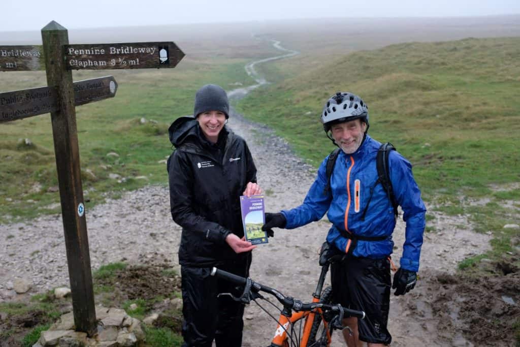
A Kendal man was the first person to receive a new map of the Pennine Bridleway National Trail.
Staff were waiting in the pouring rain with maps to give away and were beginning to question their promotional attempt when Phil Atherton emerged from the drizzle.
The new map is the first to show the entire route of the Pennine Bridleway from the Peak District in Derbyshire to Ravenstonedale in Cumbria.
It has been produced by Harvey Maps with support from the Yorkshire Dales National Park Authority’s Sustainable Development Fund.
Phil, who was in Clapham for work and had decided to take to the hills at lunchtime, said: “I read an article about the Pennine Bridleway and had to see it. Since I was over here, I thought I’d come out to do a little bit more of it. I’ve never had anything given to me like this before.”
The Yorkshire Dales National Park Authority is the lead partner of the Pennine National Trails Partnership, which looks after the route on behalf of Natural England.
Member Champion for Recreation Management at the National Park Authority, Nick Cotton, said: “The purpose of making a map which covers the entire Pennine Bridleway is to encourage more people to discover and enjoy the route.
“As a National Trail it is not yet 10 years old, so many people may not have heard of it. It runs through some very high places – a horse rider described it recently as ‘big skies all the way’. It may be a little early to talk of the festivities to come, but the map would make an excellent stocking filler.”


