

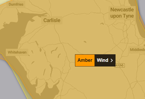
Storm Dave is set to arrive in Cumbria today – and the Met Office has issued an amber weather warning.
The Met Office has issued the amber weather warning from 7pm today, Saturday April 4, until 3am tomorrow, Sunday April 5 for strong winds.
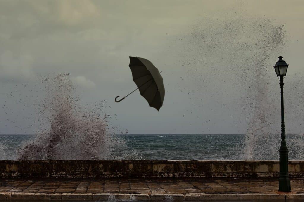
Storm Dave is expected to bring a spell of disruptive and potentially damaging winds on Saturday evening and night.
A spell of very strong southwesterly, then westerly winds is expected across north Wales, northern England and southern Scotland on Saturday evening and overnight before easing early on Sunday. Gusts of 60mph to 70mph are possible widely with some coastal or exposed locations seeing gusts of around 80mph.
The Met Office said driving in these conditions can be dangerous. it said it people must drive, they can do this more safely by taking the following actions:
- Drive slowly to minimise the impact of wind gusts
- Be aware of high sided vehicles/caravans on more exposed roads and be cautious when overtaking
- Give cyclists, motorcyclists, lorries, and buses more room than usual
It added: “Being outside in high winds makes you more vulnerable to injury. Stay indoors as much as possible. If you do go out, try not to walk, or shelter, close to buildings and trees.
“In advance of high winds, check for loose items outside your home and secure them. Items include; bins, garden furniture, trampolines, tents, sheds, and fences.
“If you are on the coast, stay safe during stormy weather by being aware of large waves.
“Even from the shore large breaking waves can sweep you off your feet and out to sea. Take care if walking near cliffs; know your route and keep dogs on a lead. In an emergency, call 999 and ask for the Coastguard.
“People cope better with power cuts when they have prepared for them in advance. It’s easy to do; consider gathering torches and batteries, a mobile phone power pack and other essential items.”
Cumbria Fire & Rescue Service is asking people to stay safe and look after others including any vulnerable people.
It added that people should keep their phones fully charged and those travelling should do so with caution and lower their speed.
What should I expect?
- Longer journey times and cancellations likely, as road, rail, air and ferry services may be affected
- Some roads and bridges likely to close
- Flying debris is likely and could lead to Injuries or danger to life
- Probably some damage to buildings, such as tiles blown from roofs
- There is a good chance that power cuts may occur, with the potential to affect other services, such as mobile phone coverage
- Injuries and danger to life is likely from large waves and beach material being thrown onto coastal roads, sea fronts and properties
On the fells
Keswick Mountain Rescue Team has urged people to go prepared if they are planning to walk in the Lake District this weekend.
It said conditions were expected to be challenging and potentially dangerous.
What to expect
- Hazardous gusts: Exceptionally strong winds are forecast for exposed ridges and summits throughout the weekend.
- Severe chill: Significant wind chill will make temperatures feel well below freezing, increasing the risk of hypothermia.
- Difficult navigation: Heavy rain and potential snow on higher ground will severely limit visibility.
It said its volunteers were always on standby, but would much rather people stayed safe and urged people to:
- Check the mountain forecast right before you leave as conditions are changing rapidly.
- Be prepared to alter your plans. There is no shame in sticking to lower-level paths or turning back if the wind picks up.
- Carry the right gear, including full waterproofs, multiple warm layers, and a map and compass (don’t rely solely on your phone!)
If you spot a problem on the road, power cut or water issues
- Roads: Cumberland Council: Report online at cumberland.gov.uk/parking-roads-and-transport or call 0300 373 3736.
- Roads: Westmorland and Furness Council: Report online at westmorlandandfurness.gov.uk/parking-streets-and-transport or call 0300 373 3306
- If you experience a power cut, call 105 for Electricity North West.
- If you experience water supply issues, call 0345 672 3723 for United Utilities.
Why should I care about weather warnings?
Weather warnings are issued to let people know what weather is in store for their area and what its impact could be.
The Met Office is the UK’s official weather service and is responsible for issuing weather warnings to the public.
There are three main levels of weather warning:
- Yellow – which asks people to be prepared for disruption
- Amber – which asks people to change plans that could be impacted by the weather and take action to protect themselves and their property
- Red – which is issued for weather that poses a danger to life and asks people to immediately take direct action to keep themselves and others safe from impacts of the weather
Yellow and amber warnings represent a range of impact levels and likelihoods of. This means it is important to read each warning to know what kind of impact to expect in your area, and how likely those impacts are to occur.
The Met Office began issuing impact-based warnings in 2011, which means that warnings are issued whenever the weather may have an impact on people’s day to day lives.
Previous to this, warnings were issued to the public when certain weather thresholds or levels were reached.
Impact-based warnings take multiple factors into account, these include time of day, if it may impact traffic, time of year, if the weather is unusual, if there are any seasonal events taking place and if the area is well equipped to deal with the weather.
Each warning level is designed to help people take steps to minimise the chances of disruption in their lives.


